Historical District 3D Map
A 3D map of a historic city block with interactive hotspots — clicking each one animates the camera down to a detailed street view paired with historical context.
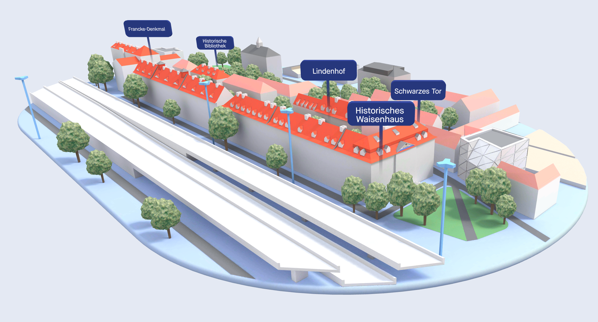
A 3D map of a historic city block with interactive hotspots. Clicking each one smoothly animates the camera down to a detailed street view paired with historical context — readers explore at their own pace instead of scrolling through static text.
Where this format works:
- Cultural institutions, museums, heritage sites that want digital experiences as compelling as in-person visits
- Tourism boards and city marketing wanting to deepen visitor engagement before they arrive
- Educational publishers covering history, architecture, urban planning
Who benefits: museums, heritage organizations, tourism authorities, history departments, publishers — anyone whose content has a strong sense of place.
The best history writing makes you feel like you're standing there. The best 3D map makes you feel like you actually are.
Want something like this for your team?
I join product and engineering teams for 4–12 weeks to ship interactive 3D experiences end-to-end. Independent contractor — no agency overhead.